Situated in Ras Beirut, a highly significant and pivotal location, this area has always held historical and cultural importance. In efforts to preserve this site, Ottoman and later French authorities entrusted the city's commons to prominent families as custodians and protectors, enforcing strict regulations against construction. However, in the 1960s, the Lebanese parliament passed a decree permitting the erection of small structures on the land with a minimal coefficient of exploitation, primarily benefiting local aristocrats who owned the plots in this region. Subsequently, in the mid-1990s, another decree was enacted, further increasing the exploitation factor and allowing for private developments along this crucial stretch of coastline.
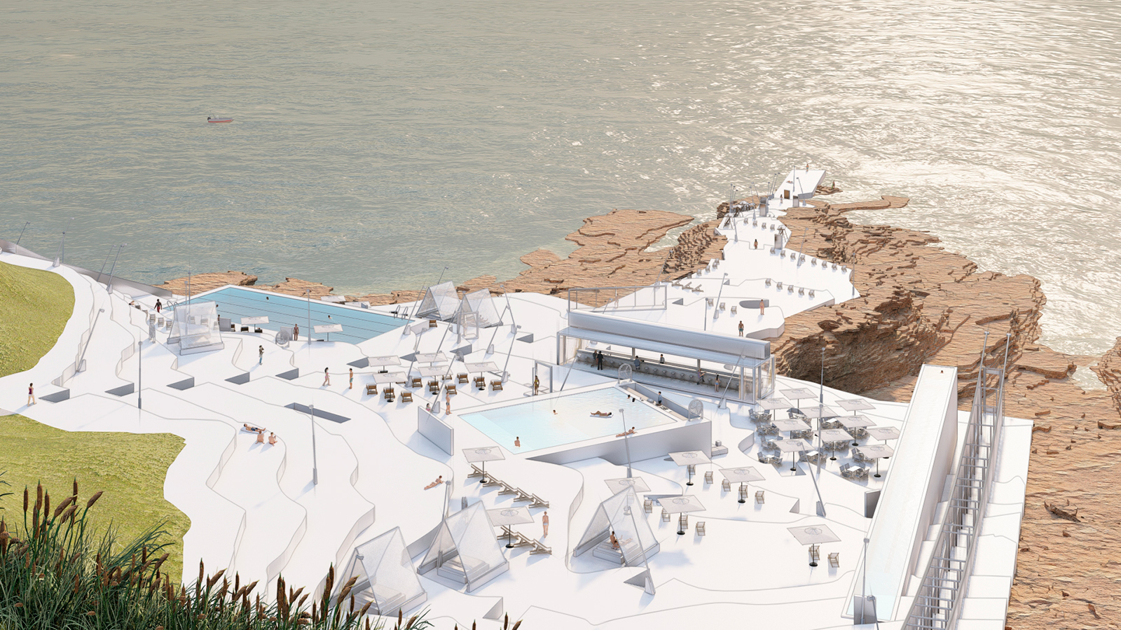
In the 2000s, a prominent local political figure acquired numerous plots along this coastline. Since then, several large-scale projects have been proposed for many of these properties, although most remained unrealized. One notable proposition included a preliminary master plan crafted by a prominent Dutch architect/town planner/ theorist, yet no public documentation of this proposal was ever disclosed. Recently, we were approached to reassess this site, considering its strategic significance and the social and political implications associated with any proposed development. Notably, our client's objective was not centered on permanent built-up exploitation but rather on revitalizing the site, celebrating its topography and connection to the Mediterranean coast, integrating the Corniche with this sector of Beirut's coastline, and providing spaces for entertainment, performances, and public events.
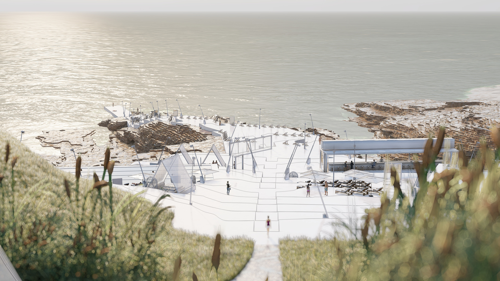
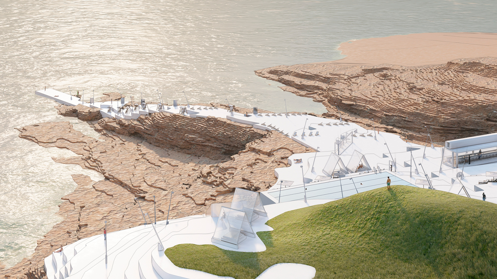
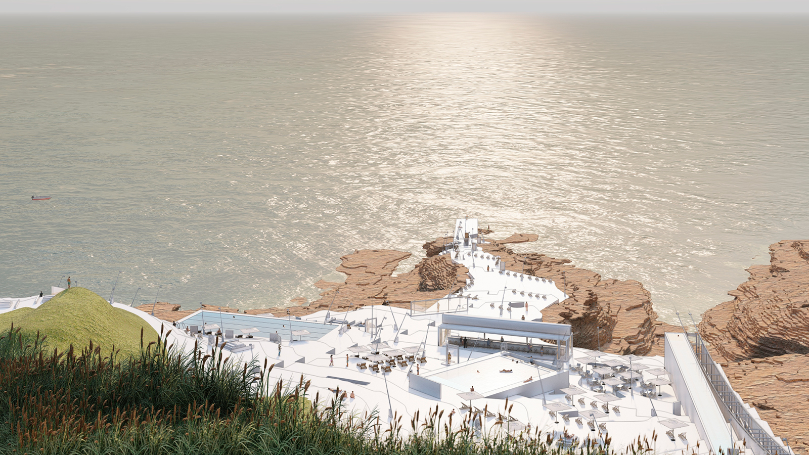
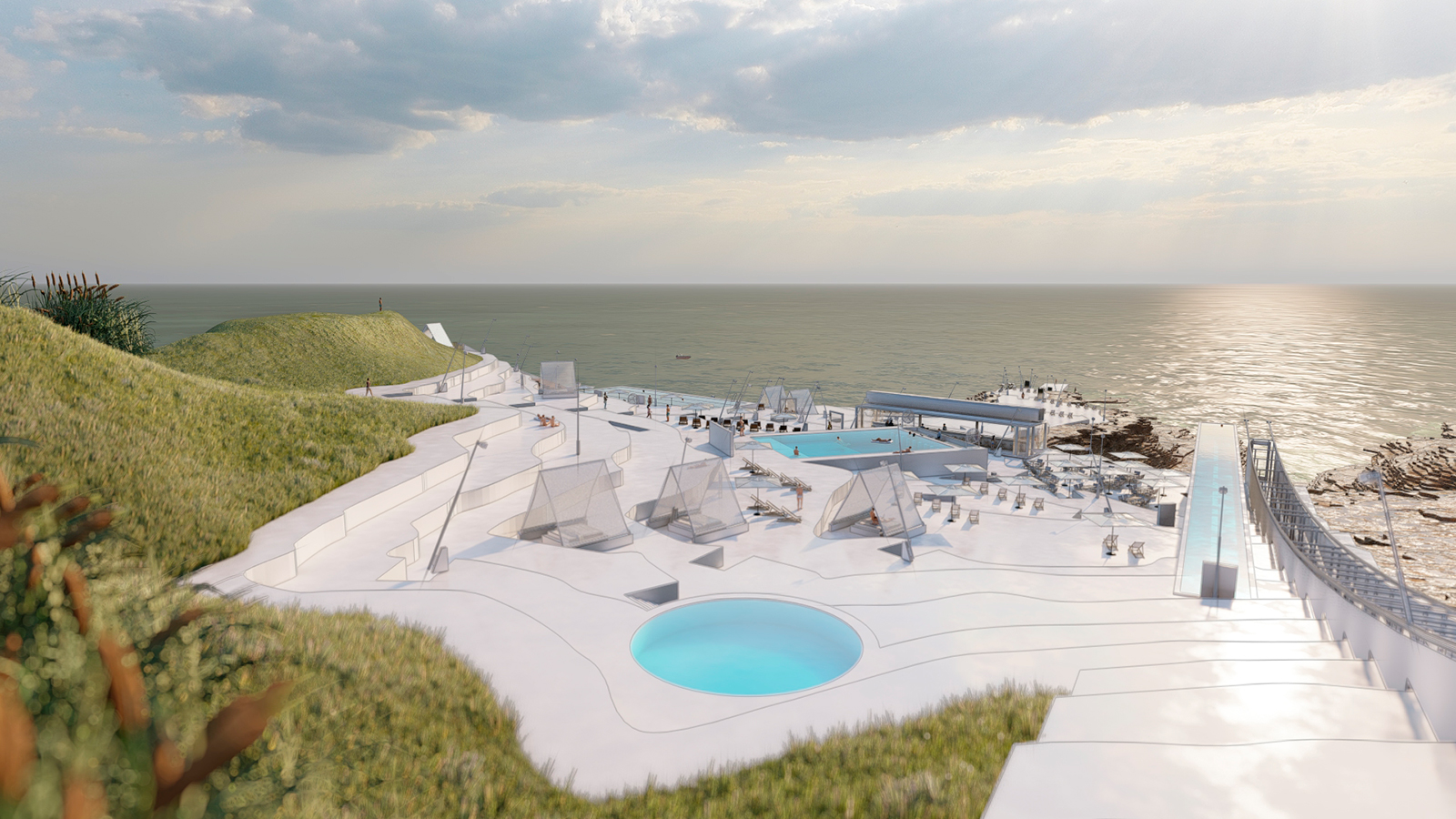
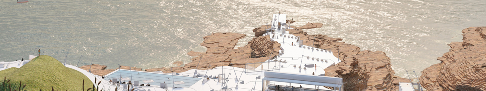
Our intervention primarily involves accentuating the topographical lines, manifested through flat plateaus ascending in 1-meter increments. These plateaus would incorporate water features such as ponds and pools, along with a dedicated public passage linking the Corniche to the historical fishermen's creek at the northern edge of the site.
Along the eastern edges of the plot, where the site intersects with the Corniche sidewalk, we propose preserving the last 12 topographical layers, corresponding to an elevation of 12 meters, in their landscaped and intact state. Positioned farthest from the coastal edge and nearest to the city, this portion of the site would delineate the permissible footprint of a private development, limited to a height of 12 meters, ensuring that any construction remains visually unobtrusive from the Corniche.